ST. GEORGE — The National Weather Service issued a flash flood watch Tuesday for a large swath of Southern Utah.
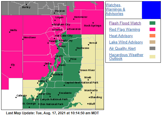
The flash flood watch goes into effect noon Tuesday and is forecast to expire late Wednesday evening. It includes the majority of Washington County, as well as portions of Iron County and the entirety of Kane, Garfield, Wayne and Piute counties.
According to the watch, thunderstorms capable of producing torrential rainfall are expected across the watch area Tuesday afternoon through Wednesday evening, with a slight decrease in rainfall rates between late Tuesday night through Wednesday morning.
Heavy rainfall may result in flash flooding, especially in slot canyons, slickrock areas, small streams and normally dry washes. Debris flows are also possible near recent burn scars.
Flash flood precautions
Flash flooding is a very dangerous situation. The public should monitor the latest forecasts and be prepared to take action. For the most current conditions, warnings and advisories, go to the National Weather Service-Salt Lake City office website.
Turn around. Don’t drown.
The National Oceanic and Atmospheric Association and the National Weather Service offer the following safety rules for flash flooding:
- Flash flood waves, moving at incredible speeds, can roll boulders, tear out trees, destroy buildings and bridges and scour out new channels. Killing walls of water can reach heights of 10 to 20 feet. You will not always have warning that these deadly, sudden floods are coming. When a flash flood warning is issued for your area or the moment you first realize that a flash flood is imminent, act quickly to save yourself. You may have only seconds.
- Most flood deaths occur in automobiles. Do not drive your vehicle into areas where the water covers the roadway. Flood waters are usually deeper than they appear. The road bed may not be intact under the water. Just one foot of flowing water is powerful enough to sweep vehicles off the road. If the vehicle stalls, abandon it immediately and seek higher ground. Rapidly rising water may engulf the vehicle and its occupants and sweep them away.
- Do not hike rivers and especially slot canyons while flash flood warnings are in place.
- Do not hike alone and always tell someone where you and your buddy and others are going.
- Get out of areas subject to flooding, including dips, low spots, canyons and washes.
- Avoid already flooded and high velocity flow areas. Do not try to cross a flowing stream on foot where water is above your knees.
- Be especially cautious at night when it is harder to recognize flood dangers.
- Do not camp or park your vehicle along streams and washes, particularly during threatening conditions.
During any flood emergency, stay tuned to official weather reports via radio, television and social media. Cell phone users can also sign up to receive weather alerts as text messages. You can also follow St. George News and Cedar City News for weather alerts and updates relevant to Southern Utah.
Copyright St. George News, SaintGeorgeUtah.com LLC, 2021, all rights reserved.