ST. GEORGE — More rain is in the forecast as the National Weather Service-Salt Lake City office has issued a flash flood watch for portions of the Southern Utah.
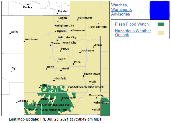
According to the flood watch, which is slated for Friday at noon through 10 p.m., thunderstorms capable of heavy rainfall are expected to develop over the Southern Utah mountains in the afternoon and move south down sensitive drainages and slot canyons across south-central and southwest Utah, including Zion National Park.
Heavy rainfall may result in flash flooding, especially in burn scars, slot canyons and normally dry washes and streams.
The current forecasts per the National Weather Service indicate the continued possibility of rain through the remainder of the holiday weekend. Below are your St. George, Cedar City, Zion National Park and Lake Powell area weekend weather forecasts, including current warnings and advisories. And for a look at this weekend’s events, check out the St. George News TGIF Show: Your weekend adventure guide brought to you by CasaBlanca Resort and Casino.
St. George
Friday
Partly sunny with high near 99 and a 20% chance of showers after 1 p.m. Light and variable winds becoming west-southwest at 8-13 mph in the afternoon.
Saturday – Pioneer Day
Partly sunny with high near 99 and a 40% chance of showers after 1 p.m. Southwest winds in the morning at 5-10 mph will shift to the east in the evening.
Sunday
Partly sunny with high near 95 and a 40% chance of showers after 1 p.m. Southwest winds in the morning at 5-9 mph
Cedar City
Friday
Partly sunny with high near 82 and a 40% chance of showers after noon. West winds in the morning at 5-10 mph will shift to the north at 6-10 mph in the evening.
Saturday
Partly sunny with high near 83 and a 50% chance of showers after noon and northeast winds at 6-11 mph.
Sunday
Partly sunny with high near 80 and a 50% chance of showers after noon. South-southwest winds at 5-8 mph will develop in the afternoon.
Zion National Park/Springdale
Friday
Partly sunny with high near 86 and a 50% chance of showers after noon. Some of the storms could produce heavy rain. North-northeast winds at 6-13 mph will shift to the west in the afternoon.
Saturday
Partly sunny with high near 85 and a 50% chance of showers after noon. North-northeast winds at 6-10 mph will shift to the south-southwest in the afternoon.
Sunday
Partly sunny with high near 81 and a 60% chance of showers after noon. Southwest winds at 5-8 mph will develop in the afternoon.
Lake Powell/Bullfrog Basin/Halls Crossing
Friday
Partly sunny with high near 96 and a 40% chance of showers after 3 p.m. North winds at 3-6 mph will shift to the west at 7-14 mph in the evening.
Saturday
Partly sunny with high near 93 and a 30% chance of showers after noon. South-southeast winds at 5-10 mph.
Sunday
Partly sunny with high near 95 and a 30% chance of showers after noon. Southeast winds at 5-8 mph.
Flash flood precautions
Flash flooding is a very dangerous situation. The public should monitor the latest forecasts and be prepared to take action. For the most current conditions, warnings and advisories, go to the National Weather Service-Salt Lake City office website.
Turn around. Don’t drown.
The National Oceanic and Atmospheric Association and the National Weather Service offer the following safety rules for flash flooding:
- Flash flood waves, moving at incredible speeds, can roll boulders, tear out trees, destroy buildings and bridges and scour out new channels. Killing walls of water can reach heights of 10 to 20 feet. You will not always have warning that these deadly, sudden floods are coming. When a flash flood warning is issued for your area or the moment you first realize that a flash flood is imminent, act quickly to save yourself. You may have only seconds.
- Most flood deaths occur in automobiles. Do not drive your vehicle into areas where the water covers the roadway. Flood waters are usually deeper than they appear. The road bed may not be intact under the water. Just one foot of flowing water is powerful enough to sweep vehicles off the road. If the vehicle stalls, abandon it immediately and seek higher ground. Rapidly rising water may engulf the vehicle and its occupants and sweep them away.
- Do not hike rivers and especially slot canyons while flash flood warnings are in place.
- Do not hike alone and always tell someone where you and your buddy and others are going.
- Get out of areas subject to flooding, including dips, low spots, canyons and washes.
- Avoid already flooded and high velocity flow areas. Do not try to cross a flowing stream on foot where water is above your knees.
- Be especially cautious at night when it is harder to recognize flood dangers.
- Do not camp or park your vehicle along streams and washes, particularly during threatening conditions.
During any flood emergency, stay tuned to official weather reports via radio, television and social media. Cell phone users can also sign up to receive weather alerts as text messages. You can also follow St. George News and Cedar City News for weather alerts and updates relevant to Southern Utah.
Copyright St. George News, SaintGeorgeUtah.com LLC, 2021, all rights reserved.