FEATURE — It plays second fiddle to Sand Hollow today, but when Quail Creek Reservoir was completed in the mid-1980s, it was a big deal. It was a project that sent Washington County in a trajectory that prepared it for growth. It became a destination for water recreation, something that was hardly foreseen in its planning stages.
It also signaled the obsolescence of early water infrastructure.
Early water development
Water is the main ingredient needed to survive an arid climate.
As such, the first order of business for Washington County’s earliest settlers was harnessing the Virgin River and its tributaries so they could irrigate future crops. Digging ditches came before building houses. Without water, they would have never survived.
Due to this fact, all early settlements within the county sprouted near a water source. In most cases, it was the Virgin River. Without any engineering education, these hardy pioneers built diversion dams and ditches that relied solely on gravity to transport the water from its source to their crops and homes.
Cleaning out ditches was a constant chore for these determined early farmers. One old-timer even told the story of having to pull trees into the river in order to divert water back to the ditch. This procedure could happen as often as two or three times a week.

Most farmers living in settlements on the eastern side of the county only cultivated small plots because of the lack of truly arable land close to the river. Their lives were backbreaking and oftentimes discouraging because of their travails with water. Some gave up and moved on to literal greener pastures after losing dams, ditches and crops over and over again.
Two of the locales that became “greener” were the LaVerkin and Hurricane benches due to canals built to run water to farms for increased cultivation. The LaVerkin Canal, on the north side of the gorge, came first, masterminded and financed largely by one man, Thomas Judd, who saw LaVerkin’s potential for growing fruit. The Hurricane Canal, on the south side of the gorge, came second and was the result of 11 years of pick-and-shovel labor. Some farmers from the upriver communities worked on the 7.5-mile canal with the promise that they would receive 20 acres (more than double what most were farming upriver) upon its completion. Many residents of upriver communities moved to Hurricane after water reached it in 1904.
In the early 1980s, many Washington County communities still depended on gravity-fed canals and ditches for their irrigation water, but the foresight of local leaders to provide better water access to a rapidly growing desert region changed that.
Need for more water resources
The 1960 census showed Washington County had a population of 10,271 full-time residents, which grew by 33% in 1970. County leaders began to realize that such sizable growth demanded better water resources. In 1962, the Washington County Water Conservancy District (WCWCD) was born “to conserve, develop and stabilize water resources in Washington County,” the Conservancy District’s book “Ditches, Diversions and Dam Determination” compiled by Ann Jensen noted.
During the 1960s and 1970s, the WCWCD considered two projects to help meet the county’s water needs. The first was known as the “Dixie Project,” which proposed a reservoir with a storage capacity of 93,300 acre feet of water. The second was known as the “Warner Valley Water Project,” which was more geared towards power generation but proposed a reservoir with 55,000 acre feet of storage capacity.
“Both of these projects went through extensive review but were eliminated from active consideration due to the coal-fired plant connected with the Warner Valley Project and the economic conditions at the time,” Jensen wrote.

In short, the projects were too expensive. The major issue at hand was water storage. Adequate Virgin River water was available in the winter and spring months, but summer flows were unpredictable and inadequate. The ability to store water for use in times of short supply became the top priority, Jensen explained.
District manager Ron Thompson and Board Member Wayne Wilson met with Utah Governor Scott Matheson to find a solution the state would support. They found out that a company known as the 5M Group had proposed a small reservoir for water storage on property they owned. In 1981, engineering company Creamer and Noble (now Jviation) completed a feasibility study of the 5M site and found it would be an ideal location for a reservoir, Jensen noted. The district then purchased 450 acres from Winding River Associates, an offshoot of 5M, which gave birth to the Quail Creek Water Reclamation Project.
The plan was for the reservoir to receive water from two sources: 3,000 acre feet per year from Quail Creek and 20,000 acre feet from the Virgin River via a diversion dam and pipeline. In November 1982, nearly 90% of Washington County residents voted in favor of a $30 million bond to fund the project, making the Quail Creek Reservoir the largest water storage project of its size in the state of Utah to be built without federal funding.
The environmental review process foresaw the reservoir as enhancing the economic base of Washington County by increasing water availability for increased agricultural yield, but envisioned a negligible economic benefit from its recreation potential. Early on, definite plans for boat ramps, campgrounds and other recreation facilities had not been hatched, Jensen explained.
The Quail Creek diversion was constructed in 1984, the largest of its kind along the Virgin River, transporting water approximately nine miles through a 66-inch pipeline. Today, this diversion also feeds nearby Sand Hollow Reservoir. The project rendered most of the canal and ditch networks, especially in the eastern side of the county, obsolete. For instance, it stopped the flow of the Hurricane Canal through the Virgin River Gorge. Water was piped into the canal near Pah Tempe Hot Springs for approximately four more years. But after that, the canal went dry for good. After the project’s completion, farmers now had access to pressurized irrigation.
The entire project, which includes two dams, was completed in April 1985.
“The primary purpose of the reservoir was and still is to provide a source of water for municipal and industrial purposes,” Jensen wrote. “It serves irrigation water to several communities, operates two hydroelectric power plants when water is plentiful and provides water to the Quail Creek Water Treatment Plant. It is also a place of beauty that affords residents and visitors a varying array of recreational and leisure opportunities.”
An official dedication ceremony was held on Sept. 20, 1985 with a crowd of 400 people that included local and state officials, legislators, engineers and contractors, all ecstatic to celebrate the fulfillment of their efforts and brimming with optimism for a more secure water future.
“You can live without a television, you can live without electricity, you can live without your automobile, but you can’t live without water,” Board Member Wayne Wilson, for whom the hydroelectric plant is named, said at the dedication ceremony.
Dam break
During 1986, 1987 and 1988, increases in seepage volume in the reservoir’s south dike along with discolored seepage and small sinkholes triggered several alarms.
The seepage issues were rectified by drilling holes 100 feet deep and pumping them with cement, water, bran and cottonseed balls. The bran and cottonseed expanded with moisture and sealed small crevices.
“Relief wells were drilled during construction to increase drainage capacity,” Jensen explained. “Two more relief wells were drilled as seepage amounts continued to increase.”
Every dam ever built experiences a little seepage, but the south Quail Creek dike’s seepage proved to be too much.
On New Year’s Eve 1988, while driving to the dam, Thompson and Wilson noticed a higher-than-normal flow at its base, which raised concern. Contractors and engineers were called in and completed a filter system around 1:30 p.m. that day.
“This system would hold in place the material coming out of the dam in the hopes that it would plug itself off,” Jensen explained. “Lloyd Jessop of the district’s operations and maintenance crew was asked to stay at the site the rest of the day to monitor any changes.”
Thompson returned to the dam late that afternoon to flows that appeared to be increasing. At 8:20 p.m., Jessop called Thompson to notify him that seepage had increased significantly and that there was not enough material available to rectify the situation. They contacted the Washington County Emergency Management office to notify it that a Quail Creek dam breach was an imminent possibility. At 10:30 p.m., they issued an evacuation order to those living within the river’s floodplain.
“By midnight, there had been a total breach of the south dike releasing a wall of water 10 to 12 feet high,” Jensen recounted. “By 12:45 a.m., the lake had dropped approximately 8 feet in a two-hour period. Between 12:45 a.m. and 1:30 a.m., the lake dropped another 8 or 9 feet.”
Thompson and Wilson’s discovery of the leak is credited with saving lives. The floodwaters carried away vehicles, RVs and even cows, but no human was reported missing. It swept away the KSGI radio transmitter, forcing the station off the air temporarily. The water from the 200-foot breach in the dike damaged more than 50 homes and 100 apartment units, forcing the evacuation of some 1,500 people, primarily in Washington City and Bloomington.

To residents of Southern Utah at the time, the dam break was akin to Pearl Harbor, the John F. Kennedy assassination and 9/11 — they remember it like it was yesterday, where they were and what they were doing. It flooded the bottom floors of homes, apartment buildings and storage units, completely ruining most items on the floor. New Year’s Day 1989 was a Sunday and several Latter-day Saint congregations canceled church services so members could form bucket brigades to bail out mud and water from damaged homes. Not surprisingly, the flood shut down New Year’s parties early. It shut down Interstate 15 for about 12 hours. It caused Hurricane residents to have to travel the long way to St. George until state Route 9 was repaired.
Experts estimated the damage to residences, businesses, and agricultural fields at approximately $10-12 million. Funds from the state legislature, insurance companies and the Federal Emergency Management Administration settled all claims and the Federal Highway Administration provided funding to rebuild roads and bridges.
An independent review team concluded that the failure resulted because embankment materials placed on the foundation were not protected from seepage erosion.
All parties involved decided to rebuild right away and if they hadn’t, according to Jensen’s account, it would have left Washington County economically stagnated and without water to accommodate growth. The new 2,000-foot-long dike was finished in 1990. It is fashioned from roller-compacted concrete that stretches 75 feet below the surface. The whole reservoir has a capacity for 40,325 acre feet of water according to the sign at the dam viewpoint.
A pipeline connecting the water treatment plant to Washington City, St. George, Santa Clara and Ivins City was completed in 2005 and in 2014, the treatment plant was expanded to increase its capacity from 50 million gallons a day to 60 million gallons a day.
A 2015 report commissioned by the WCWCD gathered 30 years worth of information since its construction to show the reservoir’s economic impact on the county.
“Quail Creek Reservoir produces enough economic impact for residents to offset its total construction costs every eight months each year, relative to the inflation-adjusted cost of $52.1 million ($23.5 million in 1985),” the report concluded. “Stated otherwise, the reservoir’s annual, recurring benefits of $77.3 million in annual output far outweighs the one-time construction cost.”
The report also stated that the reservoir provides the county with 6.5 billion gallons of water per year.
Recreation on the reservoir, perceived to be almost a non-factor in its original plan, is a huge factor today.

Quail Creek recreation today
Today, Quail Creek and its sister reservoir, Sand Hollow, completed in 2003, are recreation meccas. Boaters, fishermen, and kayakers flock to the two bodies of water within the Hurricane city limits, especially as a way to cool off during the scorching summer months.
Bill Ennis, owner of Dig Paddlesports, which has provided kayak rentals at Quail Creek Reservoir since 2013, said his business is “going gangbusters.” In general, Utah state parks have seen a huge increase in guest usage from 2019 to 2020, he explained. He said his business doubled in that time span.
“It’s good to be here,” he said. “We’ve seen steady growth year to year.”
Quail Creek Reservoir provides an easy recreation opportunity close to home, he said. In general, it sees smaller crowds because of its parking capacity, which Ennis noted is one-sixth that of Sand Hollow.
Quail Creek is especially popular as a fishing spot. Visitors will see fishing boats on the water year round. Water skiing is also popular with a water ski slalom course was installed on the reservoir’s south side three years ago.
In addition to kayak rentals, Dig Paddlesports guides kayak tours of Quail Creek, Sand Hollow and Gunlock. Paddling along the creek on the north side of Quail Creek is one of his clientele’s favorite spots, Ennis said. He described it as a “bayou experience” in which kayakers are completely enveloped in trees. While on the tour, they do not feel like they are in the desert.
One of the things about Quail Creek that Ennis enjoys is bird watching since it is a stopping place for many migratory birds. He has seen many different species of birds stop temporarily at Quail Creek, including American white pelicans, Icelandic gulls and even tropical Frigatebirds, whose home range is 3,000 miles away.
One of the advantages of choosing Quail Creek over Sand Hollow, Ennis said, is there is no chance of swimmer’s itch at Quail Creek because of the water’s favorable pH levels.
According to Ennis, at different times of the year visitors can enjoy completely different experiences due to varying water levels.
Whatever Quail Creek Reservoir visitors experience, it is certainly one that the first settlers struggling to eke out an existence utilizing ditches and canals could never have imagined.
For more information on Quail Creek Reservoir and State Park, visit its webpage.
Click on photo to enlarge it, then use your left-right arrow keys to cycle through the gallery.

This historic photo shows the 200-foot wide break in Quail Creek Reservoir's south dike, Quail Creek State Park, Utah, 1989 | Photo courtesy of John Chapman, St. George News

This historic photo shows the path the floodwaters from the Quail Creek dam break took just after the flood, Quail Creek State Park, Utah, 1989 | Photo courtesy of John Chapman, St. George News

This historic photo shows floodwaters under the Man O War Bridge in Bloomington after the Quail Creek dike break, Bloomington, Utah, 1989 | Photo courtesy of John Chapman, St. George News

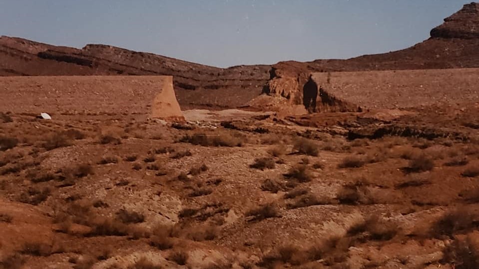
Evidence of the flood just below Quail Creek Reservoir south dam is still noticeable today, Hurricane, Utah, Feb. 3, 2021 | Photo by Reuben Wadsworth, St. George News

A lone boater enjoys the solitude on Quail Creek Reservoir, Quail Creek State Park, Utah, date unspecified | Photo courtesy of Lin Floyd, St. George News

The east side of Quail Creek Reservoir's south dam offers a panoramic view of Red Cliffs Desert Reserve and the Pine Valley Mountains, Quail Creek State Park, Utah, Feb. 1, 2021 | Photo courtesy of Mike Saemisch, St. George News

A lone boater enjoys the solitude of Quail Creek Reservoir, Quail Creek State Park, Utah, Feb. 1, 2021 | Photo courtesy of Mike Saemisch, St. George News

The view looking east from Quail Creek's south dam includes the towering monoliths of Zion National Park on the horizon, Quail Creek State Park, Feb. 3, 2021 | Photo by Reuben Wadsworth, St. George News

The new 2,000-foot south dam built in 1990 is fashioned from roller-compacted concrete, Quail Creek State Park, Feb. 3, 2021 | Photo by Reuben Wadsworth, St. George News

Water ripples on the rocky shores of Quail Creek Reservoir at dusk, Quail Creek State Park, Utah, date unspecified | Photo courtesy of Bruce Bugland, St. George News

Viewing waterfowl such as this small flock of seagulls is a common occurrence at Quail Creek Reservoir, Quail Creek State Park, Utah, date unspecified | Photo courtesy of Lin Floyd, St. George News

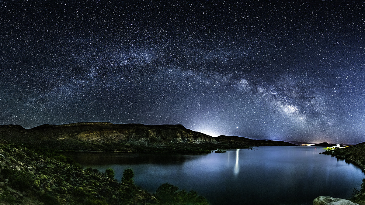
Stars shine brightly over Quail Creek Reservoir, Quail Creek State Park, Utah, May 26, 2020 | Photo courtesy of Mike Seamisch, St. George News

The water treatment plant next to Quail Creek Reservoir has a capacity of 60 million gallons per day, Quail Creek State Park, Feb. 3, 2021 | Photo by Reuben Wadsworth, St. George News
About the series “Days”
“Days” is a series of stories about people and places, industry and history in and surrounding the region of southwestern Utah.
“I write stories to help residents of southwestern Utah enjoy the region’s history as much as its scenery,” St. George News contributor Reuben Wadsworth said.
To keep up on Wadsworth’s adventures, “like” his author Facebook page or follow his Instagram account.
Wadsworth has also released a book compilation of many of the historical features written about Washington County as well as a second volume containing stories about other places in Southern Utah, Northern Arizona and Southern Nevada.
Read more: See all of the features in the “Days” series
Email: [email protected]
Twitter: @STGnews
Copyright St. George News, SaintGeorgeUtah.com LLC, 2021, all rights reserved.