ST. GEORGE — The Community Development Office within the Utah Department of Workforce Services has announced a new Graphic Information System (GIS) guide targeting cities and towns to help them better manage their municipal assets.
The guide is designed as a framework to gather and analyze geographic data that rural towns, as well as larger cities such as St. George, can use as a more effective way to manage their tangible assets, communicate and collaborate across geographic barriers, identify patterns found in the information collected, and combine a variety of geographic data in a variety of different 21st-century ways.
The guide: “GIS Applications in Municipal Government: Strategies for Small Towns” is written especially for Utah’s rural towns, but can be scaled up to assist larger cities, said Community Development Office director Keith Heaton.
“GIS technology is an accessible, (affordable) way for small towns to create more advanced management and planning tools,” Heaton said. “However, smaller municipalities may not know that this is something that their staff can learn to use. They don’t have to hire an expensive outside firm to do it.”
“Our office was formed about six years ago to help rural communities with their planning needs,” Heaton said. “We do a number of things including providing tools, guides, and resources for towns that don’t have the staff and capacity to do these types of things on their own.”
Experience shows, Heaton added, rural communities have a lot of the same needs and requirements of their larger counterparts but lack the resources, both financially and in specially trained staff, to utilize a technology-based data analysis system.
The guide provides an overview of the ways that GIS can be used by municipalities and how to get started with the technology. It recommends using GIS to:
- Manage community infrastructure and assets
- Estimate future growth demands
- Optimize public safety information and reporting
- Expand public engagement opportunities and platforms
- Share, collect and analyze critical physical and cultural municipal data
“Places like Parowan have a mayor and might have a clerk and public works person, but they lack the staff and find themselves constantly in the mode of putting out fires to keep things going,” Heaton said. “For rural communities, the 21st century is a little bit of a different world.”
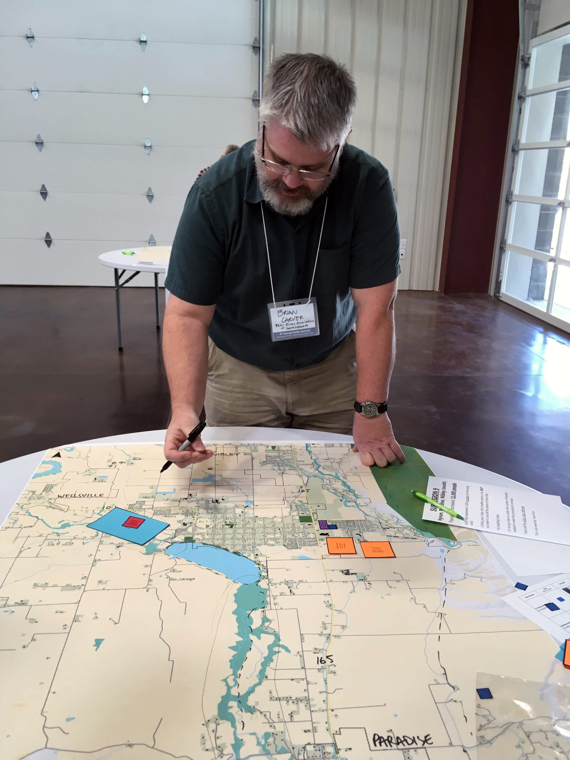
A good example where GIS can bolster a city’s understanding of its resources is in its water system.
Often times, a public works director with decades of tenure in their office knows the system like the back of their hand, but because of a lack of usable analytical or infrastructure database analysis, the information will forever remain where it is, cloistered within the memory of a department head.
“If someone else comes along and needs to know where a water shutoff is nobody else knows,” Heaton said. “There’s no documentation … and in the 21st-century towns and cities should have that data. They should have GIS and computer-based mapping with the ability to pull the information up anywhere at any time.”
Makayla Bealer, Milford City administrator/treasurer agrees that GIS technology has become an invaluable tool.
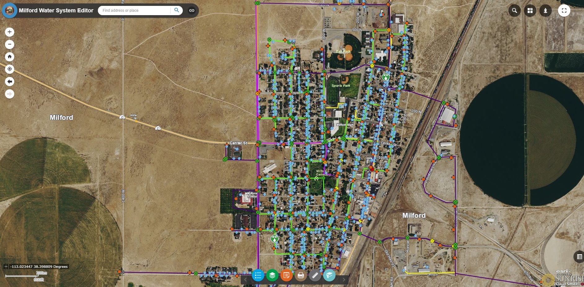
“Milford is new to GIS technology; however, we currently have had our water system on GIS, using it for a little more than one year,” she said. “It’s a great tool to keep your records updated and active for current employees, but also for future generations.”
One of the benefits, Bealer added, is that the city crews have the capability to make real-time changes to their water maps or add notes regarding a host of relevant information. Milford is currently working to get its wastewater capabilities included in a GIS format and hopes to add cemetery records as well.
“Record keeping is one of the most critical components of our jobs. GIS allows multiple employees access to mapping and helps streamlines changes to infrastructure,” Bealer said. “GIS is a big benefit to all communities, big or small. I would absolutely recommend adding this capability to all cities and towns.”
The benefit, both Bealer and Heaton said, is GIS real-time editing capability.
Instead of a long-forgotten report on community assets collecting dust on a city office shelf, quickly becoming outdated, the GIS guide is meant to be a living, usable document that changes as the needs of a city change.
“We are not mandating anything at the state level,” Heaton said. “We feel that if we make these types of things available, continually educate towns, and provide resources both at the state level but also a regional level it gives anyone the opportunity to know exactly what assets they have, provides transparency for every citizen to know what is happening in their town and provides communities to close knowledge gaps that exist.”
The lack of technology or its proper use is not exclusive to small towns, but can be found in larger metropolitan cities as well, Heaton added.
“We want to make sure every community has access to this type of mapping,” he said. “We hope larger towns also use this guide. I don’t want to overemphasize rural communities taking advantage of this guide, but the things that we produce are available to everyone and we are happy to help anyone who asks.”
The guide is available online at housing.utah.gov. Click on the link to access the guide.
Copyright St. George News, SaintGeorgeUtah.com LLC, 2020, all rights reserved.