ST. GEORGE — High winds are expected to make for a blustery day in the St. George area Monday, with winds and low humidity creating fire conditions in northern Arizona.
High winds
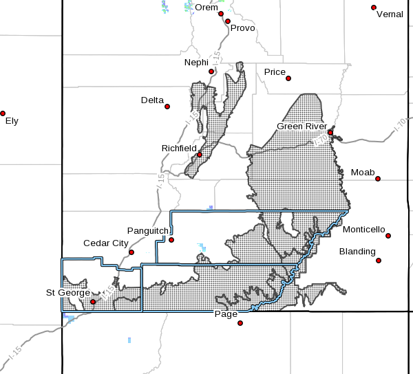
The National Weather Service has issued a wind advisory in effect Monday from noon to 10 p.m. MDT.
The wind advisory area covers much of Southern Utah, including Utah’s Dixie, Zion National Park and Glen Canyon Recreation Area/Lake Powell. Regionally affected communities include the St. George area and Kanab.
A high wind watch is also in effect for areas near Cedar City.
Read more: High winds forecast for Cedar City area, Virgin River Gorge
Southwest winds of 25 to 35 mph with gusts of up to 55 mph will be possible in the advisory area. Winds will increase significantly Monday afternoon and may remain strong through the evening before decreasing Monday night.
Travel will be impacted by strong crosswinds along east-west roadways.
Fire weather
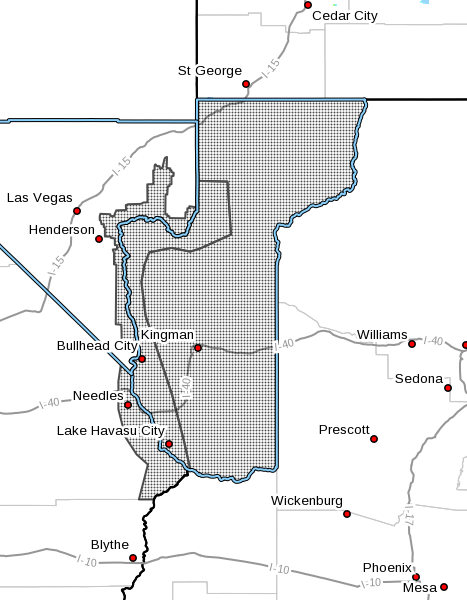
The NWS has also issued a red flag warning for northern Arizona in effect from 9 a.m. to 10 p.m. Monday.
The advisory area includes several communities in the Arizona Strip and along state Route 389, including Colorado City, and stretches south partly into Nevada in the Lake Mead National Recreation Area.
South-southwest winds with gusts of up to 50 mph will combine with humidity values of 7 to 12 percent to create critical fire weather.
Any fires that develop will likely spread rapidly. Outdoor burning is not recommended in the advisory area.
Email: [email protected]
Twitter: @STGnews
Copyright St. George News, SaintGeorgeUtah.com LLC, 2018, all rights reserved.