ST. GEORGE — Snow and rain in recent weeks have dumped enough precipitation to bring the snowpack to 150 percent of normal in Southern Utah, as the El Niño weather pattern continues.
“Typically, the El Niño in Southern Utah is typically wetter than normal,” Linda Cheng, a meteorologist with the National Weather Service in Salt Lake City, said.
“In the last couple of weeks we have seen some pretty wet storms … from that perspective, we have had some storms that are typical of El Niño.”
Southern Utah is expected to have a wetter than normal winter, Cheng said. How much wetter the season will be is not known, as it depends on how each individual storm forms. Storms coming from the north can dry out before reaching St. George unless there is a moisture surge coming from the south or southwest.
Washington County Water Conservancy District Manager Ron Thompson said the current El Niño pattern is similar to 1983 and 1998, which were both really big water years.
“This El Niño’s … as intense as those years,” Thompson said. “They don’t happen very often but when they do, they generally produce, in the Southwest, a lot of moisture.”
Southern Utah is already starting to see some moisture from the El Niño pattern, Thompson said.
“The water year, right now, looks very good,” Thompson said. Measurements for water year start in October, and the highest months for precipitation are February and March.
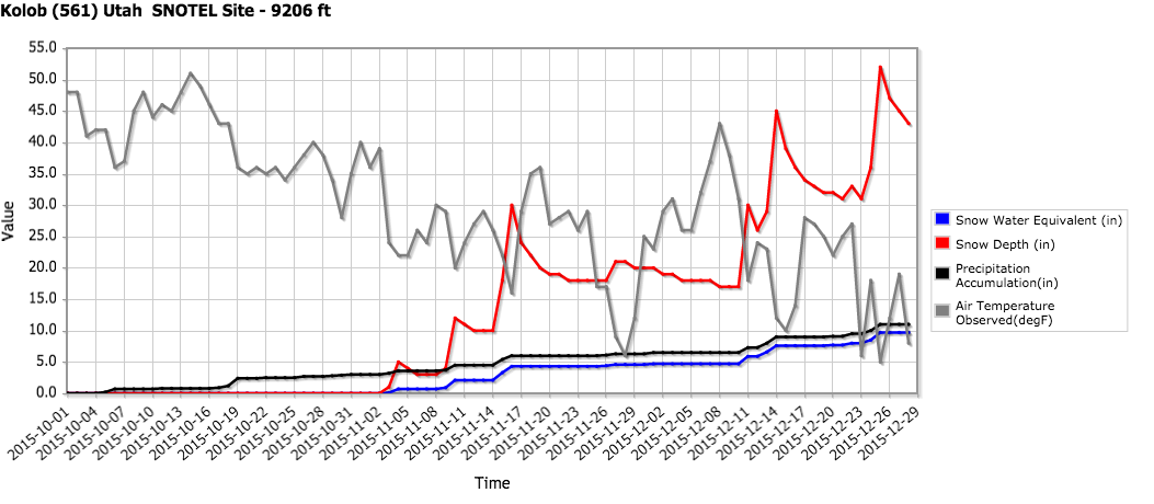
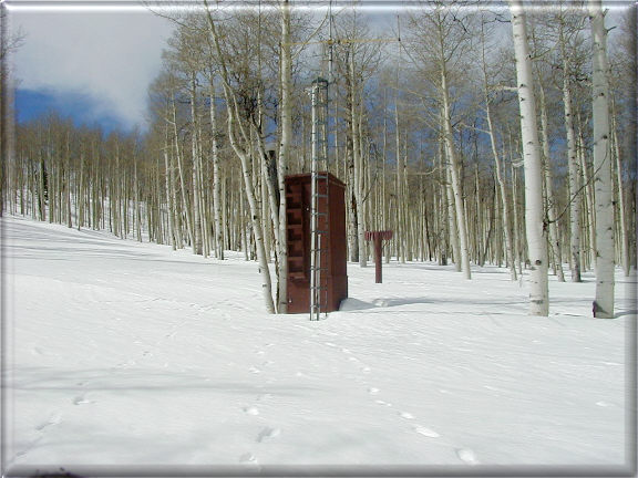
“Right now, across the basin, we’re probably an average of over 150 percent of normal,” Thompson said. The water content of snow at the top of the Virgin River watershed is at 9-10 inches, and other high snowpack areas are doing well. The Kolob measuring station has more than four feet of snow and Pine Valley has 30 inches.
“So that’s all very good at this junction,” Thompson said.
“It’s setting up to be a good water year,” he said, and although a wetter-than-normal winter is unlikely to completely break the four-year drought, it is possible.
Soil moisture conditions were very good coming into the fall, Thompson said, and early storms bode well for the year unless it rains on the snowpack, which can happen in El Niño years.
“You can create a real dry year very quickly if you get a lot of rain on that snowpack and it disappears,” Thompson said. That’s what happened in 2005 and 2010.
Winter rains can melt the snowpack, cause flooding and bring all of the moisture stored in the snow downstream too rapidly to be captured by reservoirs.
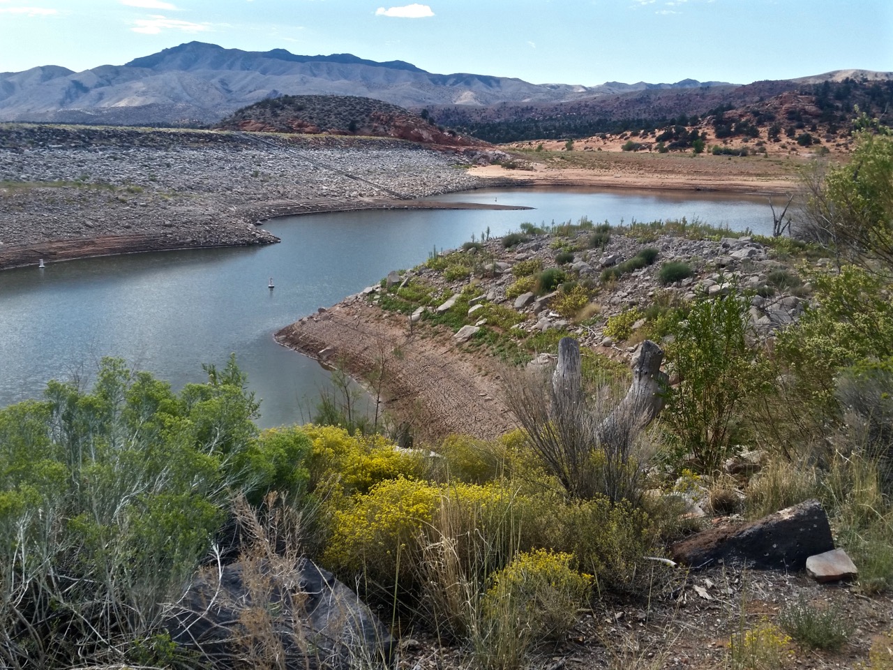
The speed of the runoff is critical because both Sand Hollow and Quail Creek reservoirs are off-stream facilities — they don’t directly capture runoff water. Instead, water is piped from the rivers into the reservoirs, so the amount that can be captured is limited by the pipe size.
Sand Hollow and Quail Creek reservoirs are 4-6 feet higher than they were at this time last year, Thompson said. Gunlock is considerably lower and Kolob Reservoir is being drawn down.
Water is being drained from Kolob Reservoir to Sand Hollow, as it is every year at this time because less water is lost to evaporation if water is stored at higher elevations, Thompson said. The reservoir will fill again in the spring.
Gunlock is low because it’s been a dry summer in the Santa Clara River drainage, but snowpack in the area looks good so far, Thompson said. Gunlock only fills about two out of every 10 years. Median flow on the Santa Clara River, which runs into Gunlock, is about 8,000 acre-feet of water. However, it can vary between 2,000 acre-feet in a very dry year to 60,000-70,000 acre-feet in a very wet year such as 2005.
“When you get a big water year, (Gunlock) can fill up in an hour, and then it spills the rest of the year,” Thompson said.
Email: [email protected]
Twitter: @STGnews
Copyright St. George News, SaintGeorgeUtah.com LLC, 2015, all rights reserved.