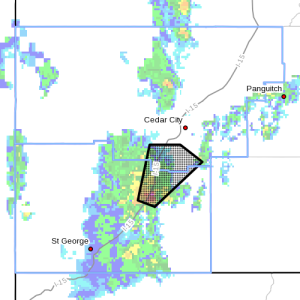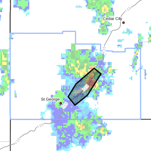
ST. GEORGE — The National Weather Service in Salt Lake City has issued a flood advisory for central Washington County Sunday until 4 p.m., as well as a severe thunderstorm warning for southeastern Iron County and northeastern Washington County until 3:15 p.m.

At 2:25 p.m., Doppler Radar indicated thunderstorms producing heavy rain. This will result in minor flooding on I-15 from Washington City to Pintura. Associated tributaries to the north of the interstate are expected to produce excessive runoff.
At 2:39 p.m., Doppler Radar indicated a severe thunderstorm capable of producing quarter-size hail and damaging winds in excess of 60 mph. This storm was located 7 miles southeast of New Harmony, 22 miles southwest of Cedar City, and moving northeast at 40 mph.
Affected areas
Flood: Washington, Hurricane, Toquerville, Leeds
Thunderstorm: Kanarraville, Pintura, Kolob Canyon
Precautionary/ preparedness actions

Do not drive your vehicle into areas where the water covers the roadway. The water depth may be too great to allow your car to cross safely. Move to higher ground.
Severe thunderstorms produce damaging winds, destructive hail, deadly lightning and very heavy rain. For your protection, move to an interior room on the lowest floor of your home or business. Heavy rains flood roads quickly, so do not drive into areas where water covers the road.
This is a Supercell thunderstorm. Due to the rotating nature of these storms, they are capable of producing all types of severe weather, including extremely large hail, destructive straight-line winds and possibly tornadoes. Move quickly to a safe shelter, preferably into a basement or an interior room such as a bathroom or closet.
Torrential rainfall is also occurring with this storm and may lead to flash flooding.
Related posts
- I can’t believe I survived; video of flash flood crashing down on canyoneers
- Traffic Advisory: Heavy traffic, rain backs up Gorge
- Zion National Park investigates September’s flash flood-related deaths
Email: [email protected]
Twitter: @STGnews