IVINS — Three trail runners and their dog got lost around 5 p.m. Sunday on top of the Red Mountain in Ivins. After spending hours shivering in the dark, they were rescued by a Washington County Search and Rescue Team, who got them off the mountain by 12:20 a.m. Monday.
Search and Rescue was able to locate their GPS coordinates from the runner’s 911 call and hike them off the mountain safely.
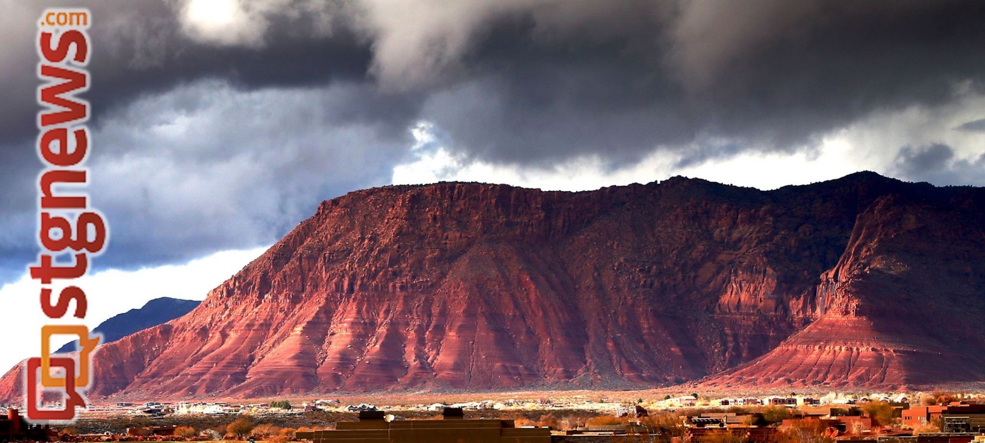
The trail runners, a couple in their 40s plus a 20-year-old woman, left the Red Mountain Trailhead off Highway 18 earlier in the day Sunday. Their planned route, which they had researched online, goes from the trailhead near Dammeron Valley, traverses to the west of Snow Canyon State Park and ends on the Gunsight Trail near Tuacahn High School.
This route is approximately 10-11 miles long and, although a large portion of it is easy and well marked, there’s a major section near the end that requires route-finding skills or prior experience with a guide, Benjamin Corso, a local hiker who has thoroughly explored this area, said.
The runners were nearing the end of their route but couldn’t find the Gunsight Trail. From their online research, they didn’t realize this section of the route descended 1,200 feet off the Red Mountain, Washington County Search and Rescue liaison, Deputy Darrell Cashin, said. Sections of this trail – particularly the area they were lost in – are unmarked and dangerous, Corso said. This area has seen 4 or 5 search and rescue responses in the last 8–9 months, Cashin said.
The runners got lost and couldn’t locate the trail or find a safe way off the Red Mountain, Cashin said. The area they were lost in is comprised of 6-7 miles of sand, sandstone, gullies, saddles, and ridges, Corso said, there is not an established or well-marked trail.
The runners tried a few different ways off the mountain but decided they were too dangerous. They called 911, and were told to stay in one place until Search and Rescue could locate them. The runners said that they were cold and shivering. They were were dressed in jogging clothes, that weren’t appropriate for a cold desert night, Cashin said.
At 6 p.m. Search and Rescue, using GPS coordinates off the runner’s 911 call, sent out a team on all-terrain vehicles from Dammeron Valley, and two hiking teams from 200 East in Ivins and their rescue base station near the Gunsight trailhead.
Because of the terrain surrounding the Red Mountain it took Search and Rescue almost three hours in the dark to find them. The team brought coats and started to hike the runners off the mountain with headlights at 8:50 p.m. There was very loose rock on their hike down the Red Mountain and it was slow going, Cashin said. Three-and-a-half hours later, they were down the mountain.
“You gotta just take your time because you don’t want to get anybody hurt,” Cashin said, “that’s why it took longer to bring them off than it did to find them.”
Search and Rescue considered calling in a helicopter but decided against it. “I just can’t justify risking a helicopter crew at night for people that are not injured,” Cashin said.
The group was contacted by cell phone four times or so throughout the rescue and said that they were fine, just cold and shivering.
“As long as they were still shivering they’re ok,” Cashin said, “it’s when you start feeling warm and quit shivering that you’ve got a problem.”
Luckily the group had a charged cell phone and was able to get cell service. The cell phone call was vital to this rescue, Cashin said. Search and Rescue can find cell signals within meters of their location if there is decent cell reception, Cashin said. However, Search and Rescue has had lots of difficulty locating GPS coordinates from prepaid phones, Cashin said.
“They can’t just tap anybody’s phone and find out where you’re at,” Cashin said, “They have to dial 911 and then they can get the GPS off of that.”
The group members – all locals – were warm by the time they got off the mountain and denied medical, Cashin said.
Deputy Chasin’s tips for backcountry exploring:
- Dress appropriately for all weather possibilities. Many people don’t realize that the desert gets extremely cold when the sun goes down. Consider clothing in case you get stuck out after dark.
- Bring extra water. Despite the fact that it’s winter, you still need extra water. These runners were down to only 10 ounces of water when they called police.
- Make sure your cell phone is charged. Like these lost runners, if you can get cell service, Search and Rescue can get a GPS location rather then search the whole area.
- Meticulously research your route or find a seasoned hiker to guide you – especially if it’s a new area. These runners researched, but thought that the trail was easier than it was. Most of the trail is well marked and easy, but a section of it isn’t.
Related posts
- Nighttime search and rescue finds two horseback riders lost off Mill Flat Trail, Pine Valley
- Search and Rescue assist woman in distress in The Subway
- Washington County Search and Rescue: Who are they? Who pays?
- Search and Rescue aids hikers in the Pine Valley Mountains
- Washington County Search and Rescue retrieves hiker on Red Mountain
Email: [email protected]
Twitter: @STGnews
Copyright St. George News, SaintGeorgeUtah.com LLC, 2014, all rights reserved.
Can we assume these were liberals since they weren’t tough enough to spend just a night up on the hill there? Crybaby libs
No dude, they were probably Tea Partiers. Tea Party nuts like to moan and complain about the ‘gubment’, but are first in line for government benefits.
.
Red Mountain Trail is best enjoyed South to North, unless you have previous experience on the route. Start in Ivins and end at the trail head next to highway 18. It’s really tough to pick out the proper route down once you reach the ridge top on Red Mountain (when starting in Dammeron Valley) because you can’t really see what’s ahead.