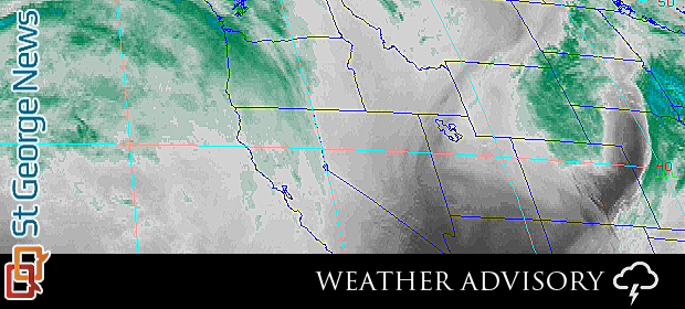
SOUTHERN UTAH – The National Weather Service has issued a “Special Weather Statement” today affecting many areas of the state, including Southern Utah.
Areas affected
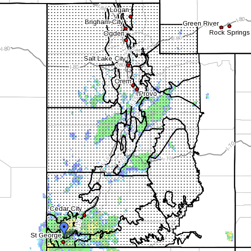
Cache Valley/Utah Portion; northern Wasatch Front; Salt Lake and Tooele Valleys; Southern Wasatch Front; Great Salt Lake desert and mountains; Wasatch Mountain valleys; Wasatch Mountains Interstate 80 north; Wasatch Mountains south of I-80; western Uinta Mountains; Wasatch Plateau/Book Cliffs; western Uinta Basin; Castle Country; San Rafael Swell; Sanpete/Sevier valleys; west central Utah; southwest Utah; Utah’s Dixie and Zion National Park; south central Utah; Glen Canyon Recreation Area/Lake Powell; central mountains; southern mountains; and southwest Wyoming.
Conditions
According to its statement released this morning, cooler and wetter weather is coming to central and southern Utah.
Significant moisture will spread into the central and southern portions of the state Sunday into early next week bringing the potential for widespread rain to the area.
In addition to the rain, significantly cooler temperatures are expected with temperatures falling 10 degrees below Friday’s readings by Sunday. Depending on how this system evolves, there may be the potential for localized flash flooding with the rainfall Sunday into Monday.
Precautionary and preparedness actions
The National Oceanic and Atmospheric Association and the National Weather Service offer safety rules for flash flooding:
- Conditions may develop that lead to flash flooding. Flash flooding is a very dangerous situation.
- Flash flood waves, moving at incredible speeds, can roll boulders, tear out trees, destroy buildings and bridges, and scour out new channels. Killing walls of water can reach heights of 10 to 20 feet. You will not always have warning that these deadly, sudden floods are coming. When a flash flood warning is issued for your area or the moment you first realize that a flash flood is imminent, act quickly to save yourself. You may have only seconds.
- Most flood deaths occur in automobiles. Do not drive your vehicle into areas where the water covers the roadway. Floodwaters are usually deeper than they appear. The road bed may not be intact under the water. Just one foot of flowing water is powerful enough to sweep vehicles off the road. If the vehicle stalls, abandon it immediately and seek higher ground. Rapidly rising water may engulf the vehicle and its occupants and sweep them away. Case in point: In July 2013 a tour bus in Arizona tipped over and got swept nearly one-half mile down an otherwise dry wash.
- Do not hike rivers and especially slot canyons while flash flood warnings are in place.
- Do not hike alone and always tell someone where you and your buddy and others are going.
- Get out of areas subject to flooding. This includes dips, low spots, canyons, washes, et cetera.
- Avoid already flooded and high velocity flow areas. Do not try to cross a flowing stream on foot where water is above your knees.
- Be especially cautious at night when it is harder to recognize flood dangers.
- Do not camp or park your vehicle along streams and washes, particularly during threatening conditions.
- During any flood emergency, stay tuned to your NOAA weather radio, commercial radio, or television, follow St. George News at STGnews.com and St. George News Facebook for weather alerts and updates relevant to Southern Utah. Information from the national weather service and disaster and emergency services may save your life.
Turn around, don’t drown.
Related posts – Storm, flash flooding
- Flood victims blame city for neglect
- Charges filed in tour bus accident
- Tour bus gets swept down wash after heavy rains
- UPDATED: Summer storm floods Coral Canyon homes; STGnews Videocast
- Flash flooding meets River Road near Southern Parkway; Videocast, STGnews photo gallery
Email: [email protected]
Twitter: @JoyceKuzmanic
Copyright St. George News, SaintGeorgeUtah.com LLC, 2013, all rights reserved.